


ukmaps.co.uk
Greater Manchester District Admin Map - Digital Download
Greater Manchester District Admin Map - Digital Download
Couldn't load pickup availability
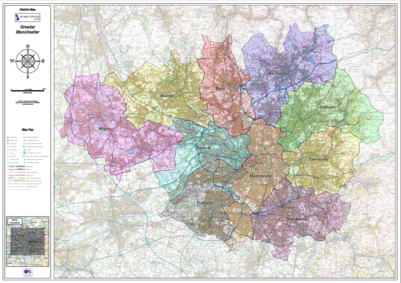
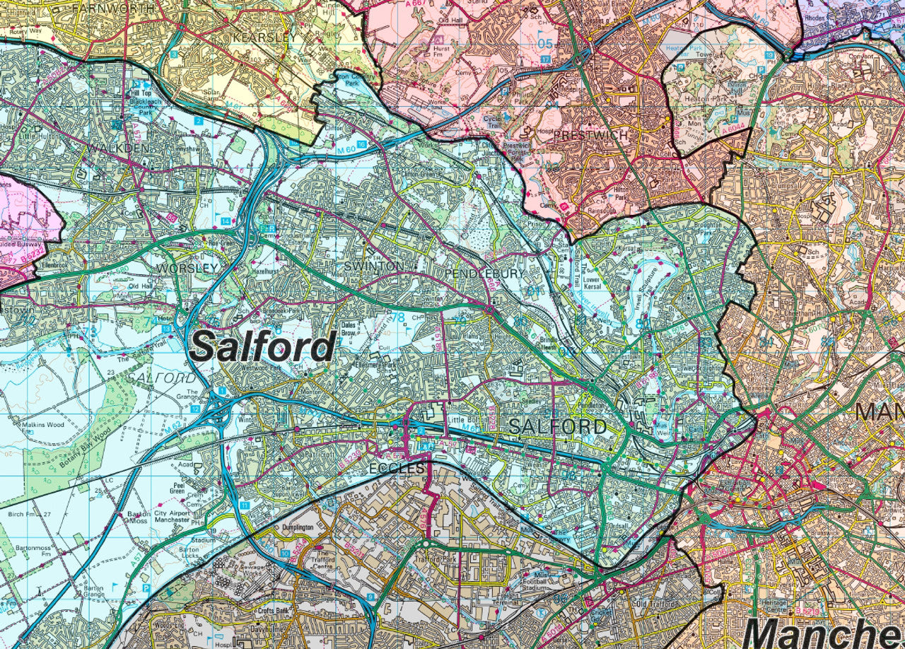
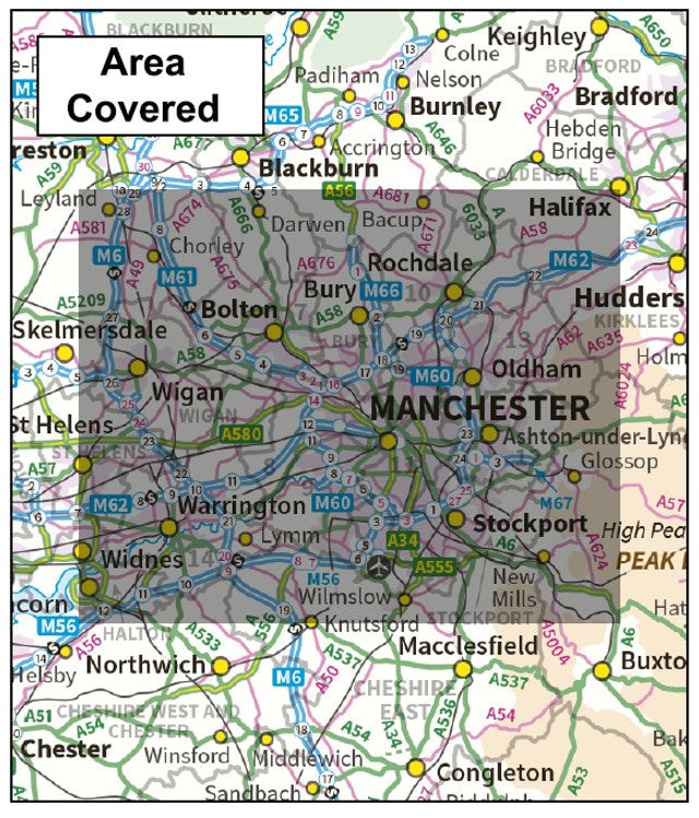
The Greater Manchester District Admin map uses OS mapping overlaid with the Metropolitan Borough Boundary lines making this ideal for office use and for planning in the city. The maps utilises up-to-date 1:50,000 scale OS map data (scaled to 1:55,000) to clearly display the city and its environs. The Metropolitan Borough Boundaries are highlighted with different colours for clarity and ease of use.
- 1:55,000 OS map of Greater Manchester District Displaying the District County Boundaries
- Boundaries are highlighted with different colours for clarity and ease of use
- Supplied as High Quality 300dpi PDF image
- Download Supplied on Order Completion
- File Size: 187mb
- When Printed: Size: 1120mm x 841mm
Digital Download Products can not be returned once a purchase has been made. Please read the T&C's before making a purchase. Please Note: Once you place an order the file will be available to download for 14 days. If you intend to make multiple prints of the map you should increase the quantity box accordingly. This product has been created using up-to-date scaled Ordnance Survey 1:50,000 scale mapping.
About the County Boundary Map Digital Download Series: As the way we live and work changes so too do the products and data we need. With this in mind we've made our Wall Maps available as PDF's to download which can be used as digital maps, on a computer, tablet or phone, or can even be taken to your local print shop and printed to the correct scale. All our maps are created from up-to-date Ordnance Survey mapping and are regularly updated.
Share
Additional Information
Custom Maps
If you can't find a map to suit your needs we will happily quote you for a custom map.
Email your request to: custom@ukmapcentre.com or complete our online custom request form via this link > Custom Map Form
Subscribe to our emails
Be the first to know about new collections and exclusive offers.