


ukmaps.co.uk
Borders Abbey Way Route Map - Digital Download
Borders Abbey Way Route Map - Digital Download
Couldn't load pickup availability
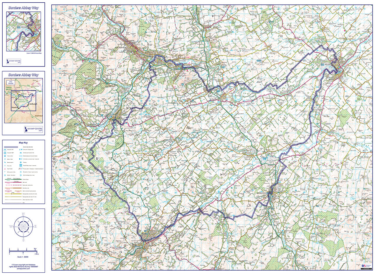
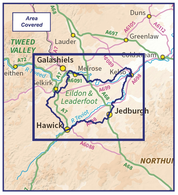
The Borders Abbey Way map is an essential aid for anyone planning and undertaking the 107km (66.4 mile) circular route which takes in the abbies at Melrose, Dryburgh, Jedburgh, and Kelso. As it's a circular route the walk can be started anywhere along the way and can be broken into five days each starting and ending at a scenic Borders town.
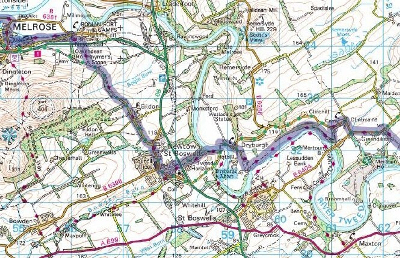
The UK Map Centre has created a unique map-sheet which captures the area using up-to-date Ordnance Survey 1:50,000 scale mapping. The route is highlighted for easy navigation, and in common with all 50k scale mapping, other popular footpaths are marked alongside roads, towns and local tourist attractions. This route map covers the whole route on one sheet.
- Borders Abbey Way Route Map
- 1:50,000 Scale Ordnance Survey Mapping
- Route Highlighted for easy navigation
- Map Size if Printed at Actual Size: 80cm x 60
- Supplied as High Quality 300dpi PDF image
- Download supplied on Order Completion
- File size:89mb
Digital DownloadProducts can not be returned once a purchase has been made. Please read the T&C's before making a purchase. Please Note: Once you place an order the file will be available to download for 14 days. If you intend to make multiple prints of the map you should increase the quantity box accordingly. This product has been created using up-to-date Ordnance Survey 1:50,000 Scale mapping
Share

Additional Information
Custom Maps
If you can't find a map to suit your needs we will happily quote you for a custom map.
Email your request to: custom@ukmapcentre.com or complete our online custom request form via this link > Custom Map Form
Subscribe to our emails
Be the first to know about new collections and exclusive offers.