


ukmaps.co.uk
Postcode Area 4 - Southern England & Wales - Digital Download
Postcode Area 4 - Southern England & Wales - Digital Download
Couldn't load pickup availability
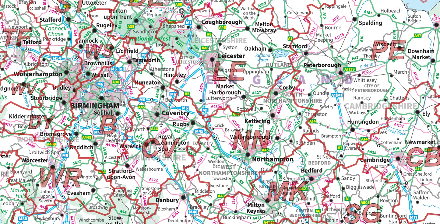
Postcode Area Map 4 - South England & Wales
This map shows the South of England and Wales combining Ordnance Survey mapping with Area level Postcode data to provide a high quality and functional map, ideal for country-wide business planning, dispatch warehouses etc.
This map file is supplied as a high quality PDF which can be downloaded on the order confirmation page.
- 1:500000 scale map of the Southern areas of the United Kingdom
- Postcode Area details are outlined in red for clarity e.g. Postcode HR denotes the Hereford Postcode Area
- Map Size at actual size: 1189mm x 841mm
- Ideal for displaying nationwide survey figures
- Contains insets for Central London & the Isles of Scilly
- Supplied as a high quality PDF
Postcodes Covered on this Map
Postcodes Covered on this Map
AL, B, BA, BH, BL, BN, BR, BS, CB, CF, CH, CM, CO, CR, CT, CV, CW, DA, DE, DN, DT, DY, E, EC, EX, GL, GU, HA, HD, HP, HR, IG, IP, KT, L, LD, LE, LL, LN, LU, M, ME, MK, N, NE, NG, NN, NP, NR, NW, OL, OX, PE, PL, PO, RG, RH, RM, S, SA, SE, SG, SK, SL, SM, SN, SO, SP, SS, ST, SW, SY, TA, TF, TN, TQ, TR, TW, UB, W, WA, WC, WD, WN, WR, WS, WV
Share

About Digital Download Maps
About the Postcode Area Map Series
The Postcode Area Map Series of Maps uses Ordnance Survey Miniscale Mapping overlayed with Postcode Area data. These maps are ideal for businesses and organisations targeting countries or very large regions of the UK,
Digital Downloads
Supplied as a High Quality PDF these maps are set up as 'Ready-To-Print' files which can
be printed at your local large-format print shop to scale. Alternatively this map can be used on any electronic device which has a PDF reader.
Brief Terms
Digital Download Products can not be returned once a purchase has been made. Please read the T&C's before making a purchase.
Please Note:
Once you place an order the file will be available to download for 14
days. If you intend to make multiple prints of the map you should
increase the quantity box accordingly
Custom Maps
If you can't find a map to suit your needs we will happily quote you for a custom map.
Email your request to: custom@ukmapcentre.com or complete our online custom request form via this link > Custom Map Form
Subscribe to our emails
Be the first to know about new collections and exclusive offers.