

ukmaps.co.uk
London Boroughs Postcode Map - Digital Download
London Boroughs Postcode Map - Digital Download
Couldn't load pickup availability
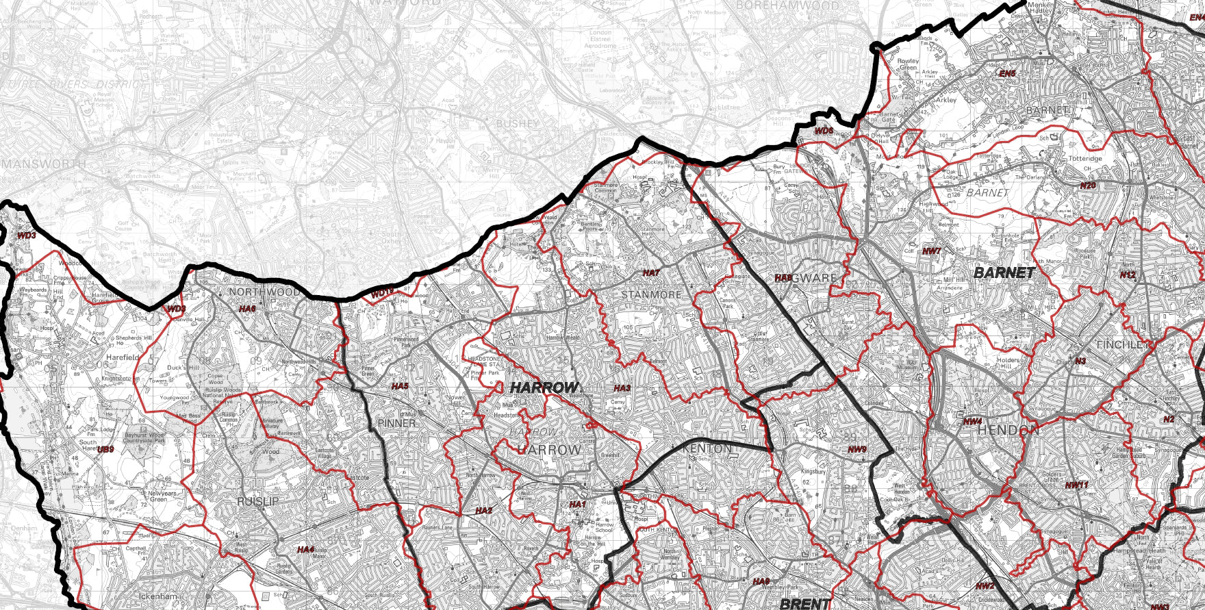
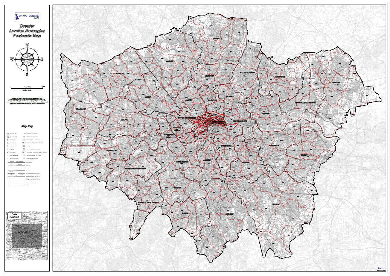
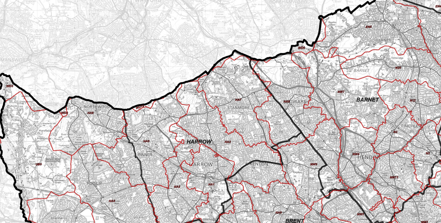
The Greater London Authority Borough Postcode District Map is a 1:55000 scale map of London which displays the boroughs and the postcode districts of the city making this ideal for city, district and borough planning. Created using up-to-date OS 1:50,000 scale mapping (scaled to 1:55,000) this map gives great detail for the city.
- 1:55,000 OS map of London Displaying the borough Boundaries and Postcode District detail
- Borough Boundaries Postcode districts are highlighted for clarity and ease of use
- Supplied as High Quality 300dpi PDF image
- Download Supplied on Order Completion
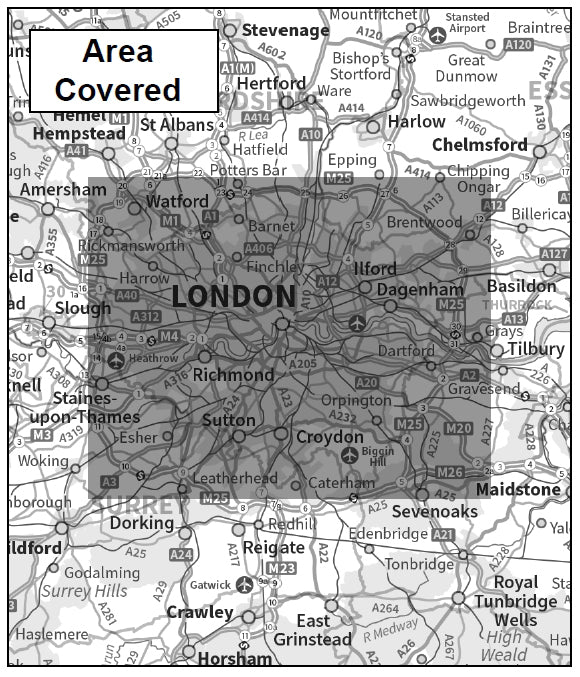
- When Printed: Size: 1120mm x 841mm
Postcodes Covered on this Map
Postcodes Covered on this Map
BR1, BR2, BR3, BR4, BR5, BR6, BR7, BR8, CM13, CM14, CR0, CR2, CR3, CR4, CR5, CR6, CR7, CR8, DA1, DA14, DA15, DA16, DA17, DA18, DA5, DA6, DA7, DA8, E1, E10, E11, E12, E13, E14, E15, E16, E17, E18, E1W, E2, E20, E3, E4, E5, E6, E7, E8, E9, EC1A, EC1M, EC1N, EC1R, EC1V, EC1Y, EC2M, EC2N, EC2R, EC2V, EC2Y, EC3A, EC3M, EC3N, EC3R, EC3V, EC4A, EC4M, EC4N, EC4R, EC4V, EC4Y, EN1, EN2, EN3, EN4, EN5, EN6, EN7, EN8, EN9, HA0, HA1, HA2, HA3, HA4, HA5, HA6, HA7, HA8, HA9, IG1, IG11, IG2, IG3, IG4, IG5, IG6, IG7, IG8, IG9, KT1, KT10, KT18, KT19, KT2, KT22, KT3, KT4, KT5, KT6, KT7, KT8, KT9, N1, N10, N11, N12, N13, N14, N15, N16, N17, N18, N19, N1C, N2, N20, N21, N22, N3, N4, N5, N6, N7, N8, N9, NW1, NW10, NW11, NW2, NW3, NW4, NW5, NW6, NW7, NW8, NW9, RM1, RM10, RM11, RM12, RM13, RM14, RM15, RM2, RM3, RM4, RM5, RM6, RM7, RM8, RM9, SE1, SE10, SE11, SE12, SE13, SE14, SE15, SE16, SE17, SE18, SE19, SE2, SE20, SE21, SE22, SE23, SE24, SE25, SE26, SE27, SE28, SE3, SE4, SE5, SE6, SE7, SE8, SE9, SL3, SM1, SM2, SM3, SM4, SM5, SM6, SM7, SW10, SW11, SW12, SW13, SW14, SW15, SW16, SW17, SW18, SW19, SW1A, SW1E, SW1H, SW1P, SW1V, SW1W, SW1X, SW1Y, SW2, SW20, SW3, SW4, SW5, SW6, SW7, SW8, SW9, TN14, TN16, TW1, TW10, TW11, TW12, TW13, TW14, TW15, TW16, TW19, TW2, TW3, TW4, TW5, TW6, TW7, TW8, TW9, UB1, UB10, UB11, UB2, UB3, UB4, UB5, UB6, UB7, UB8, UB9, W10, W11, W12, W13, W14, W1B, W1C, W1D, W1F, W1G, W1H, W1J, W1K, W1S, W1T, W1U, W1W, W2, W3, W4, W5, W6, W7, W8, W9, WC1A, WC1B, WC1E, WC1H, WC1N, WC1R, WC1V, WC1X, WC2A, WC2B, WC2E, WC2H, WC2N, WC2R, WD19, WD3, WD6
Boroughs on this Map
Boroughs on this Map
Barking and Dagenham, Barnet, Bexley, Brent, Bromley, Camden, City and County of the City of London, City of Westminster, Croydon, Ealing, Enfield, Greenwich, Hackney, Hammersmith and Fulham, Haringey, Harrow, Havering, Hillingdon, Hounslow, Islington, Kensington and Chelsea, Kingston upon Thames, Lambeth, Lewisham, Merton, Newham, Redbridge, Richmond upon Thames, Southwark, Sutton, Tower Hamlets, Waltham Forest & Wandsworth
Share
About Digital Download Maps
About the Postcode City Sector Map Series
The Postcode City Sector Map Series of Maps cover most of the large population centres in the UK using Ordnance Survey Street View Mapping. Scaled at 1:10,000 this mapping provides clear views of all the road names and public buildings. We've overlaid the mapping with Postcode Sector data. This makes these maps ideal for businesses targeting specific areas of a city.
Digital Downloads
Supplied as a High Quality PDF these maps are set up as 'Ready-To-Print' files which can
be printed at your local large-format print shop to scale. Alternatively this map can be used on any electronic device which has a PDF reader.
Brief Terms
Digital Download Products can not be returned once a purchase has been made. Please read the T&C's before making a purchase.
Please Note:
Once you place an order the file will be available to download for 14
days. If you intend to make multiple prints of the map you should
increase the quantity box accordingly
Custom Maps
If you can't find a map to suit your needs we will happily quote you for a custom map.
Email your request to: custom@ukmapcentre.com or complete our online custom request form via this link > Custom Map Form
Subscribe to our emails
Be the first to know about new collections and exclusive offers.