

ukmaps.co.uk
Postcode District Map 7 - South West England & South Wales - Digital Download
Postcode District Map 7 - South West England & South Wales - Digital Download
Couldn't load pickup availability
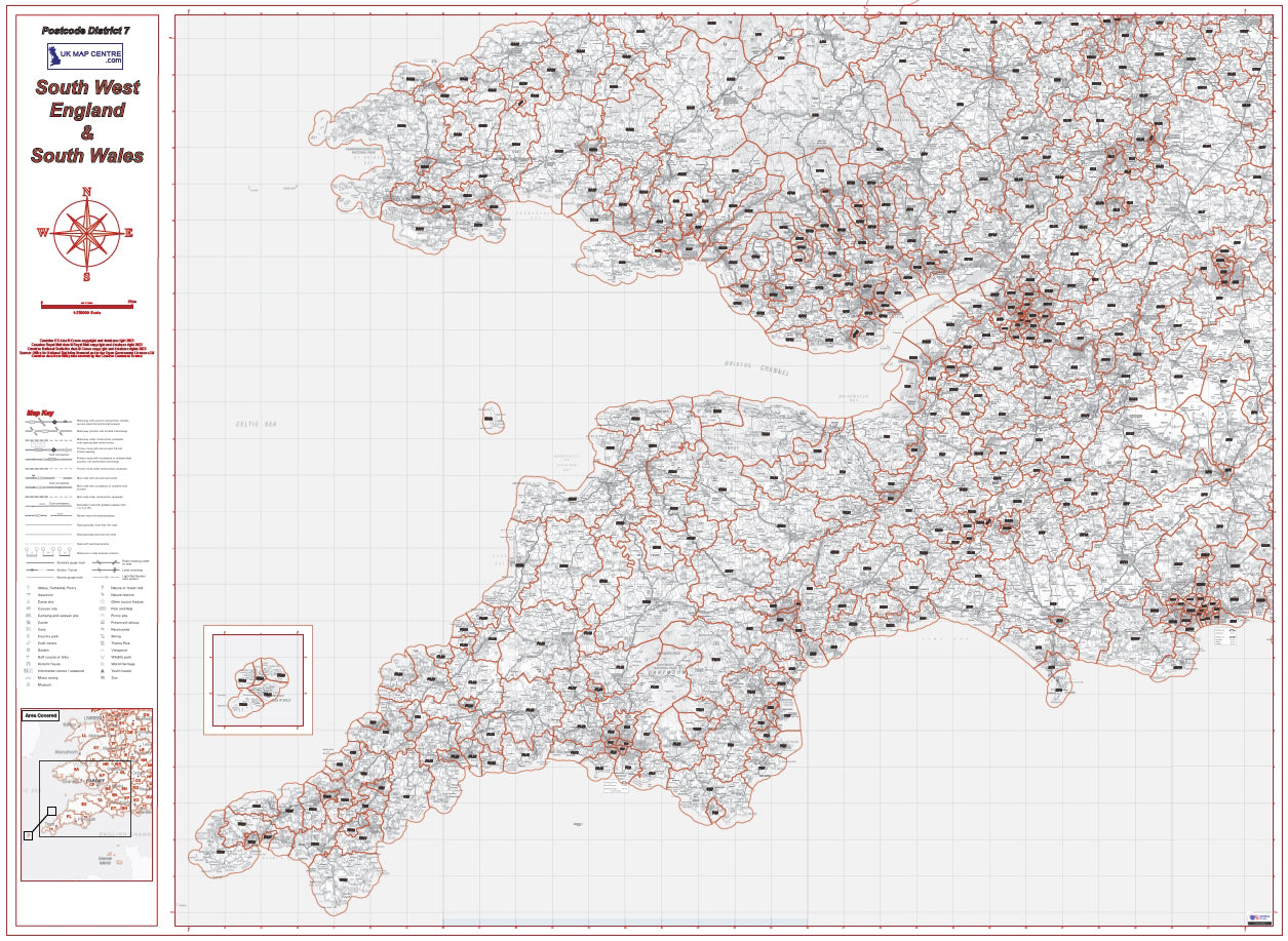
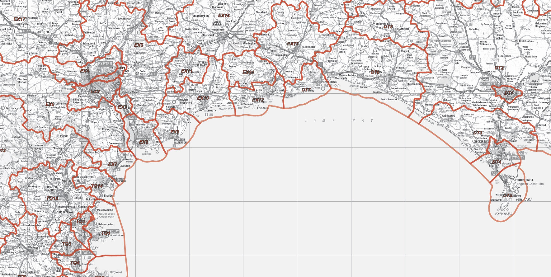
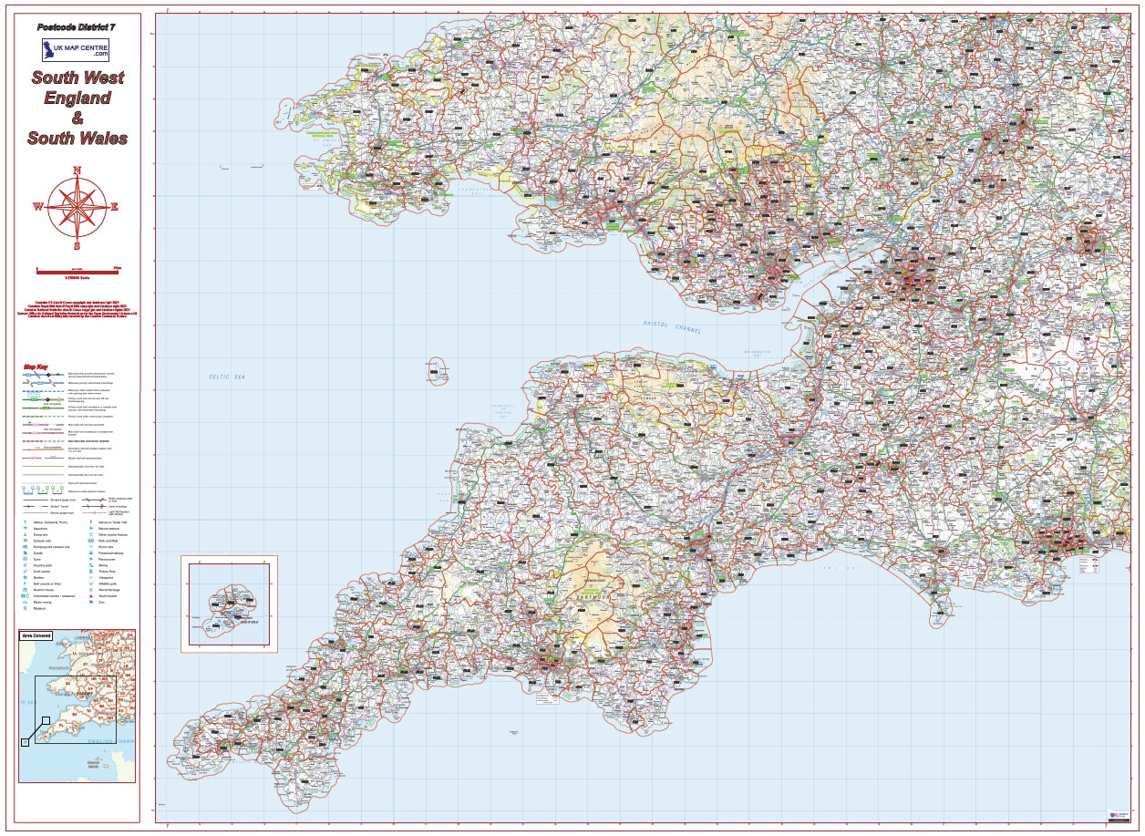
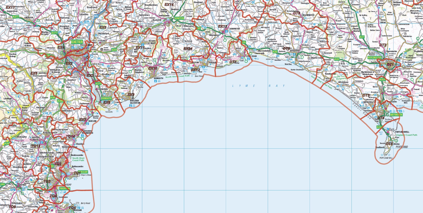
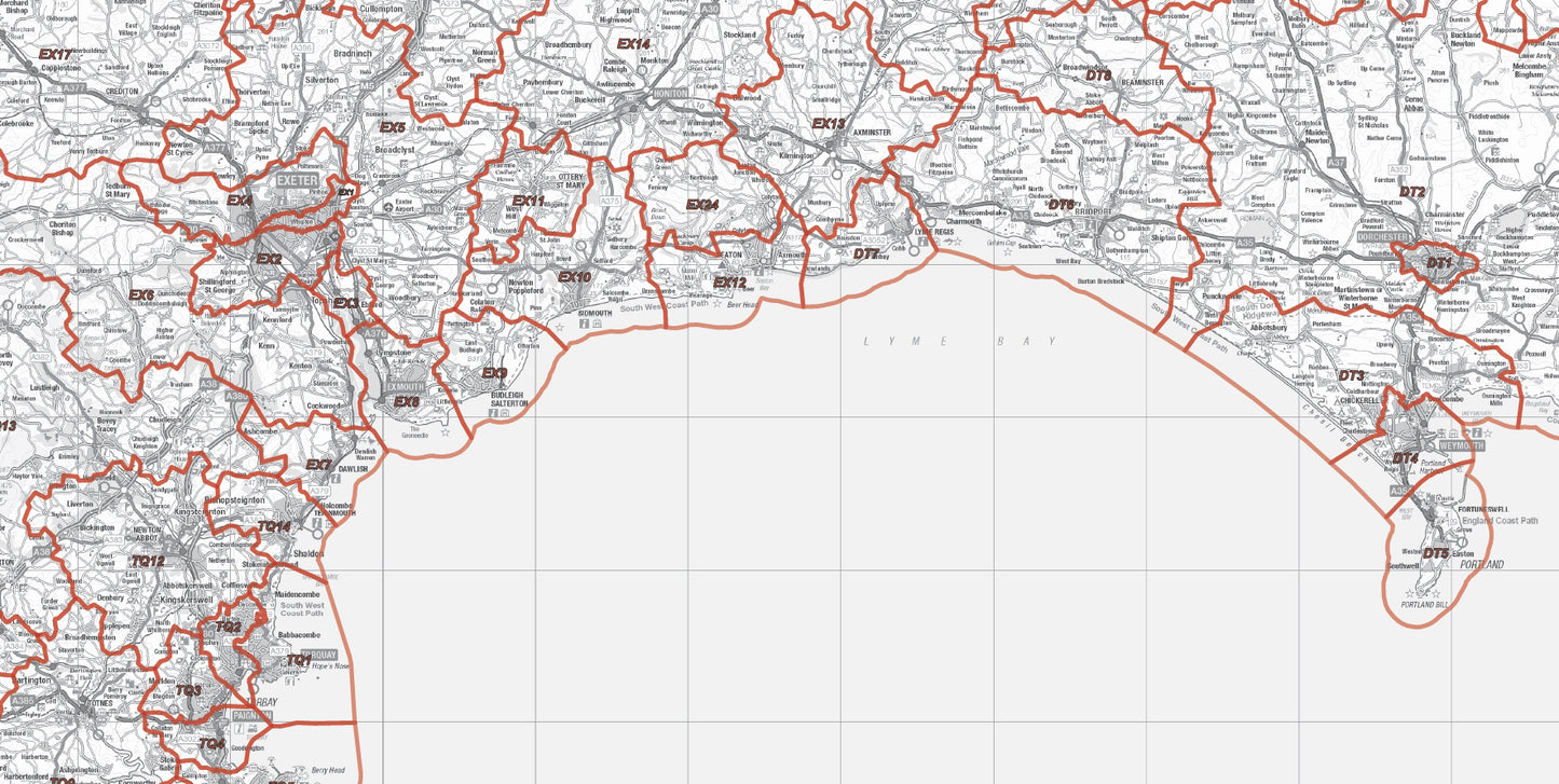
The Postcode District Map 7 features District Postcodes for the South West of England & South Wales utilising the Ordnance Survey 1:250,000 mapping data. Includes an inset for the Scilly Isles for ease of use. The mapping is overlaid with District level Postcode boundaries to provide a clear and functional map ideal for use in control room and dispatch offices or warehouses.
This map file is supplied as a high quality PDF which can be downloaded on the order confirmation page.
- 1:250000 scale map of South West England & South Wales
- Covers Penzance, Plymouth, Exeter, Bournemouth, Bristol, Swindon, Gloucester, Cheltenham, Swansea, Cardiff and Newport and Includes an inset for the Scilly Isles
- Map size if printed: 1400mm x 1000mm
- Supplied as a high quality PDF
Postcodes Covered on this Map
Postcodes Covered on this Map
B50, BA1, BA10, BA11, BA12, BA13, BA14, BA15, BA16, BA2, BA20, BA21, BA22, BA3, BA4, BA5, BA6, BA7, BA8, BA9, BH1, BH10, BH11, BH12, BH13, BH14, BH15, BH16, BH17, BH18, BH19, BH2, BH20, BH21, BH22, BH23, BH24, BH25, BH3, BH31, BH4, BH5, BH6, BH7, BH8, BH9, BS1, BS10, BS11, BS13, BS14, BS15, BS16, BS2, BS20, BS21, BS22, BS23, BS24, BS25, BS26, BS27, BS28, BS29, BS3, BS30, BS31, BS32, BS34, BS35, BS36, BS37, BS39, BS4, BS40, BS41, BS48, BS49, BS5, BS6, BS7, BS8, BS9, CF10, CF11, CF14, CF15, CF23, CF24, CF3, CF31, CF32, CF33, CF34, CF35, CF36, CF37, CF38, CF39, CF40, CF41, CF42, CF43, CF44, CF45, CF46, CF47, CF48, CF5, CF61, CF62, CF63, CF64, CF71, CF72, CF81, CF82, CF83, CV36, CV37, DT1, DT10, DT11, DT2, DT3, DT4, DT5, DT6, DT7, DT8, DT9, EX1, EX10, EX11, EX12, EX13, EX14, EX15, EX16, EX17, EX18, EX19, EX2, EX20, EX21, EX22, EX23, EX24, EX3, EX31, EX32, EX33, EX34, EX35, EX36, EX37, EX38, EX39, EX4, EX5, EX6, EX7, EX8, EX9, GL1, GL10, GL11, GL12, GL13, GL14, GL15, GL16, GL17, GL18, GL19, GL2, GL20, GL3, GL4, GL5, GL50, GL51, GL52, GL53, GL54, GL55, GL56, GL6, GL7, GL8, GL9, HR1, HR2, HR3, HR4, HR5, HR6, HR7, HR8, HR9, LD2, LD3, LD4, LD5, NP10, NP11, NP12, NP13, NP15, NP16, NP18, NP19, NP20, NP22, NP23, NP24, NP25, NP26, NP4, NP44, NP7, NP8, OX18, OX7, PL1, PL10, PL11, PL12, PL13, PL14, PL15, PL16, PL17, PL18, PL19, PL2, PL20, PL21, PL22, PL23, PL24, PL25, PL26, PL27, PL28, PL29, PL3, PL30, PL31, PL32, PL33, PL34, PL35, PL4, PL5, PL6, PL7, PL8, PL9, SA1, SA10, SA11, SA12, SA13, SA14, SA15, SA16, SA17, SA18, SA19, SA2, SA20, SA3, SA31, SA32, SA33, SA34, SA35, SA36, SA37, SA38, SA39, SA4, SA40, SA41, SA42, SA43, SA44, SA48, SA5, SA6, SA61, SA62, SA63, SA64, SA65, SA66, SA67, SA68, SA69, SA7, SA70, SA71, SA72, SA73, SA8, SA9, SN1, SN10, SN11, SN12, SN13, SN14, SN15, SN16, SN2, SN25, SN26, SN3, SN4, SN5, SN6, SN8, SN9, SO43, SP1, SP2, SP3, SP4, SP5, SP6, SP7, SP8, SP9, SY25, TA1, TA10, TA11, TA12, TA13, TA14, TA15, TA16, TA17, TA18, TA19, TA2, TA20, TA21, TA22, TA23, TA24, TA3, TA4, TA5, TA6, TA7, TA8, TA9, TQ1, TQ10, TQ11, TQ12, TQ13, TQ14, TQ2, TQ3, TQ4, TQ5, TQ6, TQ7, TQ8, TQ9, TR1, TR10, TR11, TR12, TR13, TR14, TR15, TR16, TR17, TR18, TR19, TR2, TR20, TR21, TR22, TR23, TR24, TR25, TR26, TR27, TR3, TR4, TR5, TR6, TR7, TR8, TR9, WR1, WR10, WR11, WR12, WR13, WR14, WR2, WR5, WR6, WR7, WR8
Share

About Digital Download Maps
About the Postcode District Map Series
The Postcode District Map Series of Maps splits the country into 8 maps, covering them using Ordnance Survey Road Mapping. Scaled at 1:250,000 this mapping clearly shows villages, towns and cities, the road and rail networks and is all overlayed with Postcode District data. These maps are ideal for businesses and organisations targeting large regions of the country.
Digital Downloads
Supplied as a High Quality PDF these maps are set up as 'Ready-To-Print' files which can
be printed at your local large-format print shop to scale. Alternatively this map can be used on any electronic device which has a PDF reader.
Brief Terms
Digital Download Products can not be returned once a purchase has been made. Please read the T&C's before making a purchase.
Please Note:
Once you place an order the file will be available to download for 14
days. If you intend to make multiple prints of the map you should
increase the quantity box accordingly
Custom Mapping
If you can't find a map to suit your needs we will happily quote you for a custom map.
Email your request to: custom@ukmapcentre.com or complete our online custom request form here > Custom Map Form
Subscribe to our emails
Be the first to know about new collections and exclusive offers.